

You can find on this page the Morocco satellite map to print and to download in PDF. The Morocco map from satellite presents new pictures of Morocco as seen from the sky in Africa.
The Morocco satellite map shows new pictures of Morocco as seen from the sky. This satellite map of Morocco will allow you to visit the country Morocco in Africa as seen from the sky. The Morocco satellite map is downloadable in PDF, printable and free.
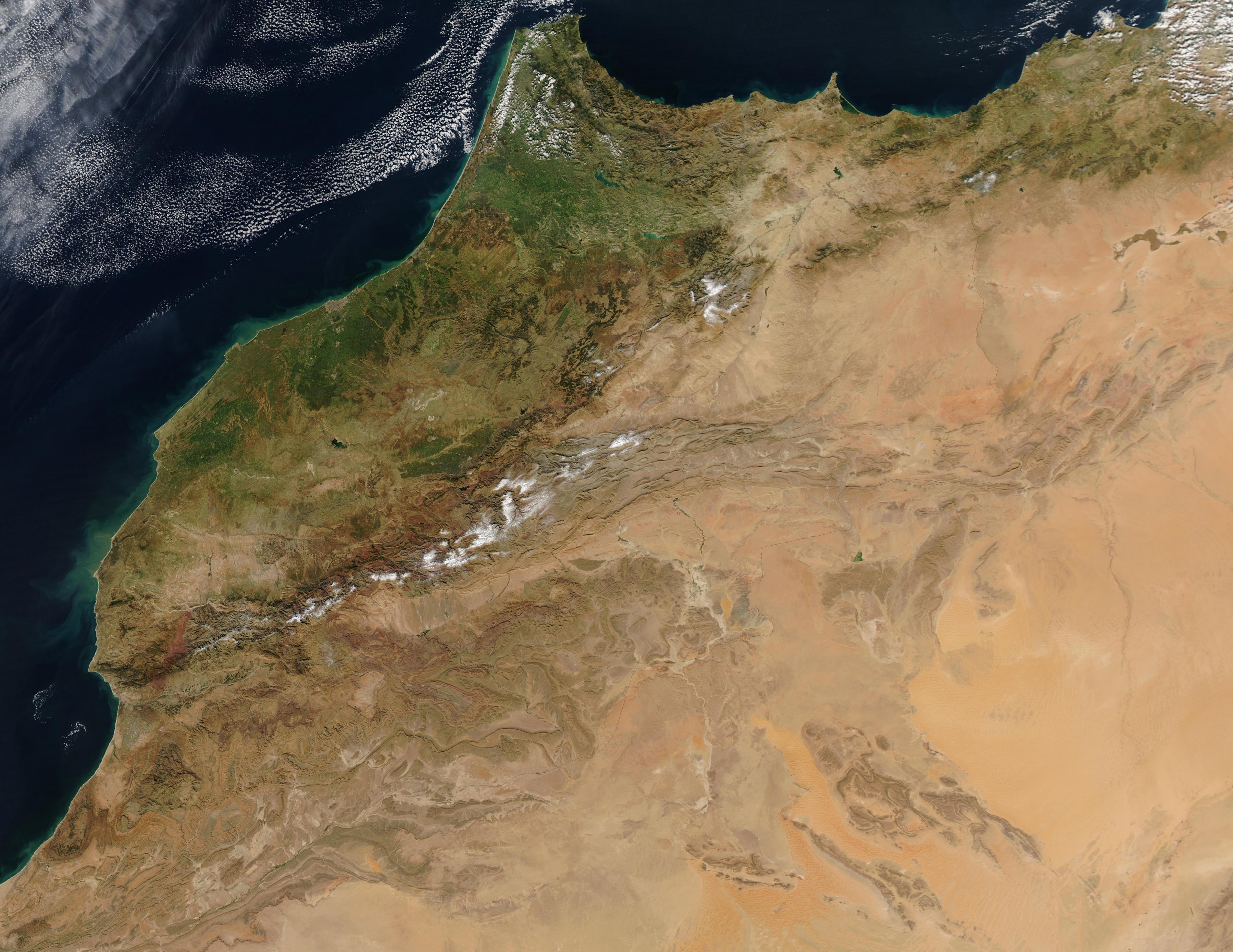
Morocco is located in northwestern Africa. This map shows the physical features of Morocco, much of Morocco's landscape is mountainous with slopes that gradually transition into plateaus and valleys as its mentioned in Morocco satellite map. The Atlas mountains dominate the central part of the country, while the Rif mountains make up the northern edge.
Generally, Morocco climate is moderate and subtropical, cooled by breezes off the Atlantic and Mediterranean. In the interior the temperatures are more extreme, winters can be fairly cold and the summers very hot. In fact, the further you go from the ocean the more extreme winter and summer temperatures become as you can see in Morocco satellite map.
Morocco spans from the Mediterranean Sea and Atlantic Ocean on the north and the west respectively, into large mountainous areas in the interior body, to the Sahara desert in the far south as its shown in Morocco satellite map. Morocco is a Northern African country, located in the extreme north west of Africa on the edge of continental Europe.