

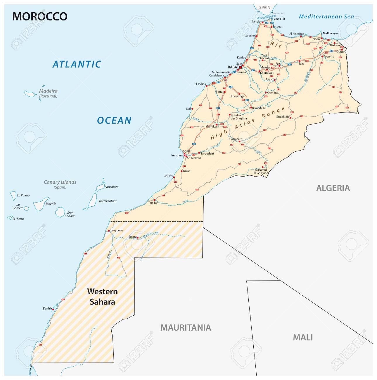
You can find on this page the Morocco road map to print and to download in PDF. The Morocco driving map presents the detailed road network, main highways and free motorways of Morocco in Africa.

The Morocco road map shows all roads network and main roads of Morocco. This road map of Morocco will allow you to preparing your routes and find your routes through the roads of Morocco in Africa. The Morocco roads map is downloadable in PDF, printable and free.
Morocco has one of the best road systems on the continent. Over the past 20 years, the government has built approximately 1,100 miles of modern roads as its mentioned in Morocco roads map, connecting most major cities via toll expressways. The Moroccan Ministry of Equipment, Transport, Logistics, and Water aims to build an additional 2,100 miles of expressway and 1,300 miles of highway by 2030, at an expected cost of $9.6 billion.
Morocco enjoys one of the most highly developed infrastructures in Africa. The country is served by a network of 57,847 kilometers (35,946 miles) of primary and secondary roads as you can see in Morocco roads map, of which 30,254 kilometers (18,800 miles) are paved. With growing numbers of licensed automobiles, the road system, especially in urban areas, has become highly congested. According to official statistics, road accidents claim up to 3,000 lives annually. Plans are currently underway to modernize the country railway system, which plays an important role in the transport of phosphates and their derivatives.
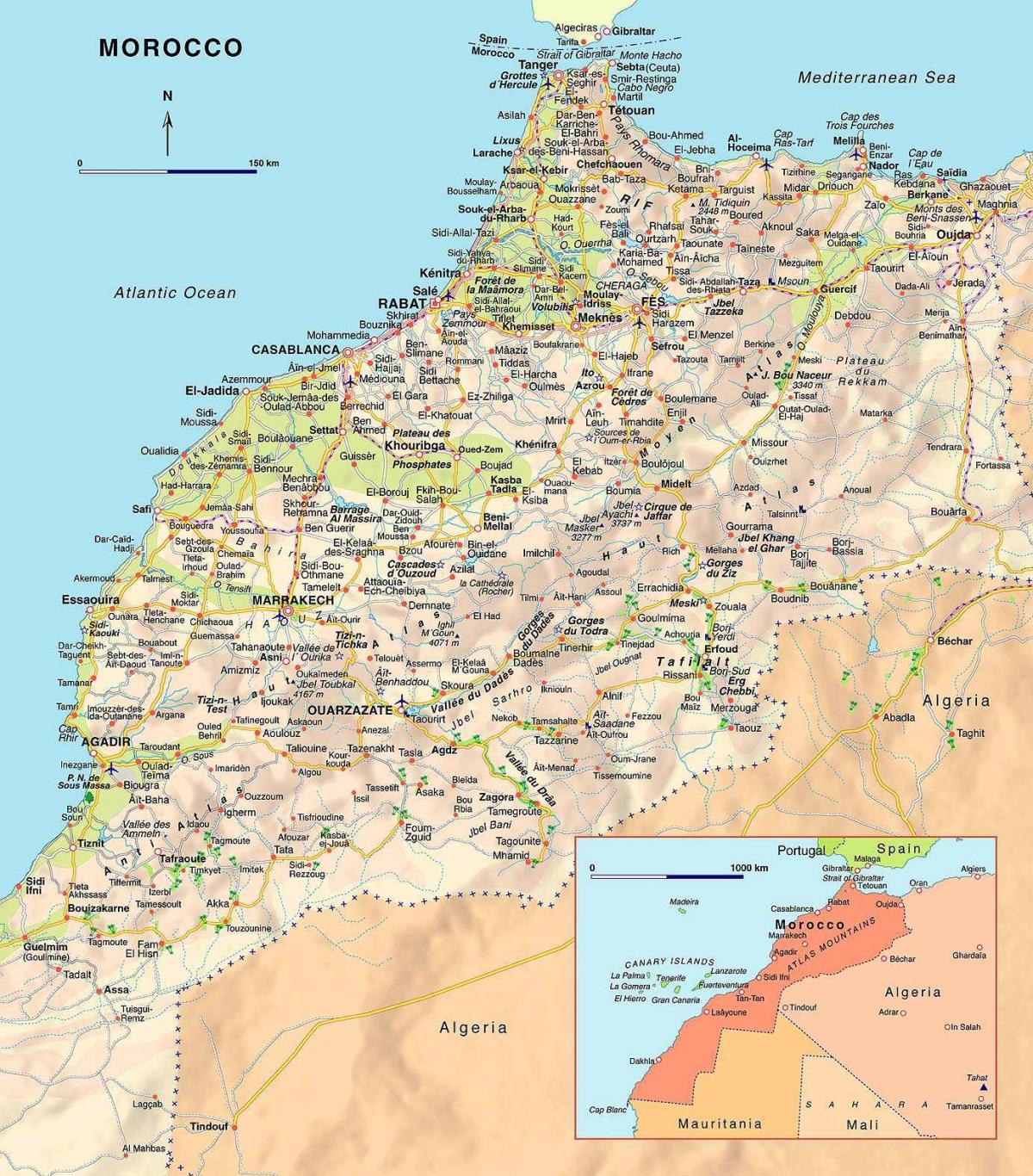
Morocco is spending 2.8% of its annual budget on maintaining and building roads as part of its 2008-2012 plan as its shown in Morocco roads map. For 2010, the state will allocate a budget of US$777 million on roads, a significant increase over the $413.6 million spent in 2006. Construction of 210 new roads totalling 2,600km will be launched which will end isolation for 72% of rural areas. Around 1,900km will be completed in 2010 including the Chichaoua-Agadir highway link and the Rabat ring road.
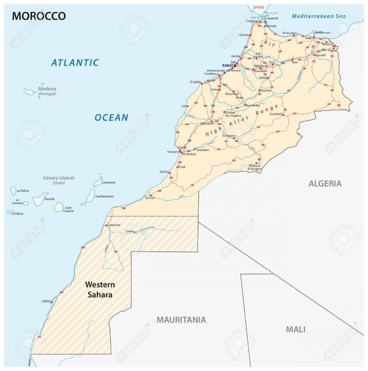
The Morocco highway map shows toll and free motorways of Morocco. This highways map of Morocco will allow you to prepare your routes on motorways of Morocco in Africa. The Morocco highway map is downloadable in PDF, printable and free.
The Ministry of Equipment, Transport and Logistics (Ministère de l’Equipement, du Transport et de la Logistique, METL) is in charge of road development and aims to build an additional 3400 km of expressways and 2000 km of highways by 2030 (see Morocco highway map), at an estimated cost of $9.6bn. Part of this work will include the Dh1.7bn ($177.1m), 30-km Tit Mellil-to-Berrechid highway, the construction of which should start in 2020; and the Dh5bn ($520.9m), 60-km Rabat-to-Tit Mellil highway, which will alleviate traffic between the economic and political capitals.
As of January 2020 Morocco road network consists of more than 57,330 km of road, of which 76% is paved. National roads account for 41% of the country network while regional and provincial roads make up 21% and 18%, respectively. The remaining 20% consists of highways and expressways managed by the Moroccan Highway Administration (Autoroutes du Maroc, ADM) as its shown in Morocco highway map.
Morocco is planning a new highway connecting the key cities of Rabat and Casablanca as its mentioned in Morocco highway map. Construction will start on a new highway connection linking Rabat and Casablanca in Morocco during 2020. The existing motorway between Morocco capital, Rabat, and its economic centre, Casablanca, suffers from heavy congestion at peak periods at present. The 86km highway carries up to 85,000 vehicles/day at times and averages around 65,000 vehicles/day.